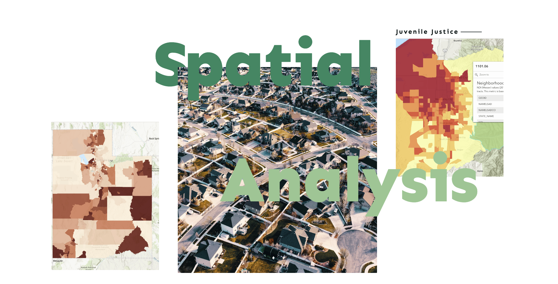
Juvenile Justice Spatial Analysis
We are using geospatial data and analysis tools to build a compass 🧭 for juvenile justice policy. We believe spatial data can be used as a community asset. Our spatial tools📍and research are designed to be a community organizing tool for policymakers, youth, and community members to co-create their vision for youth safety and support. 🫱🏽🫲🏾 🏡
Spatial Research
Our research helps communities develop targeted solutions addressing root causes affecting youth and families across Utah neighborhoods, providing data-driven insights for community-based interventions.

Utah Statewide Study: Phase 1
We are excited to share Phase I of our Juvenile Justice Statewide Geospatial Study. This study identifies youth court referral hot spots across Utah and through a composite risk score develops the Top 100 Priority Neighborhoods for targeted support.
Our next steps focus on partnering with interested communities, youth, and families to develop strength-based approaches that address the root causes affecting youth and families in neighborhoods across Utah.

Salt Lake County Study
We present our first spatial study of juvenile justice data in 2023 where we aim to understand the neighborhood impacts on juvenile justice outcomes and where court referrals spatially cluster across Salt Lake County (SLCO).
The key policy takeaway from the study's result is: How can we mitigate juvenile justice contact by supporting the households and the communities they live in to alleviate socioeconomic and care burdens?

Statewide Full Study
Phase II of the Juvenile Justice Statewide Geospatial Study examines how neighborhood conditions and socioeconomic factors influence juvenile justice outcomes across UT communities.
Using advanced spatial modeling, we will examine the complex relationships between concentrated disadvantage, community resources, and youth referral patterns. This analysis will inform more effective place-based interventions for UT communities.
Research Snapshot: Wasatch Front
Policy zones identify neighborhoods with the greatest opportunity for impact on youth outcomes.📍These are opportunity neighborhoods - places where coordinated support can significantly improve outcomes for youth, their families, and the communities they live in. 🏘️ See which neighborhoods make up the Wasatch Front! 🧭
Community Engagement Workshops
Community Engagement Workshops seek to center residents as the experts of their own experiences. These workshops begin with the understanding that every community has its own strengths and its solutions. The Juvenile Justice team at CCJJ can facilitate a community workshop in your neighborhood that can be used to generate specific, individualized, and community-driven responses to youth justice issues.
2025 - 2026 Geospatial Presentations
Newsletter
Juvenile Justice Newsletter Archive
Browse past issues for updates on youth justice research, programs, and community engagement across Utah.
- CCJJ Juvenile Justice Newsletter — April 2026 April 7, 2026
- CCJJ Juvenile Justice Newsletter — January 2026 January 7, 2026
- CCJJ Juvenile Justice Newsletter — October 2025 October 7, 2025
- CCJJ Juvenile Justice Newsletter — July 2025 July 8, 2025
- CCJJ Juvenile Justice Newsletter — April 2025 April 7, 2025
- CCJJ Juvenile Justice Newsletter — January 2025 January 2025